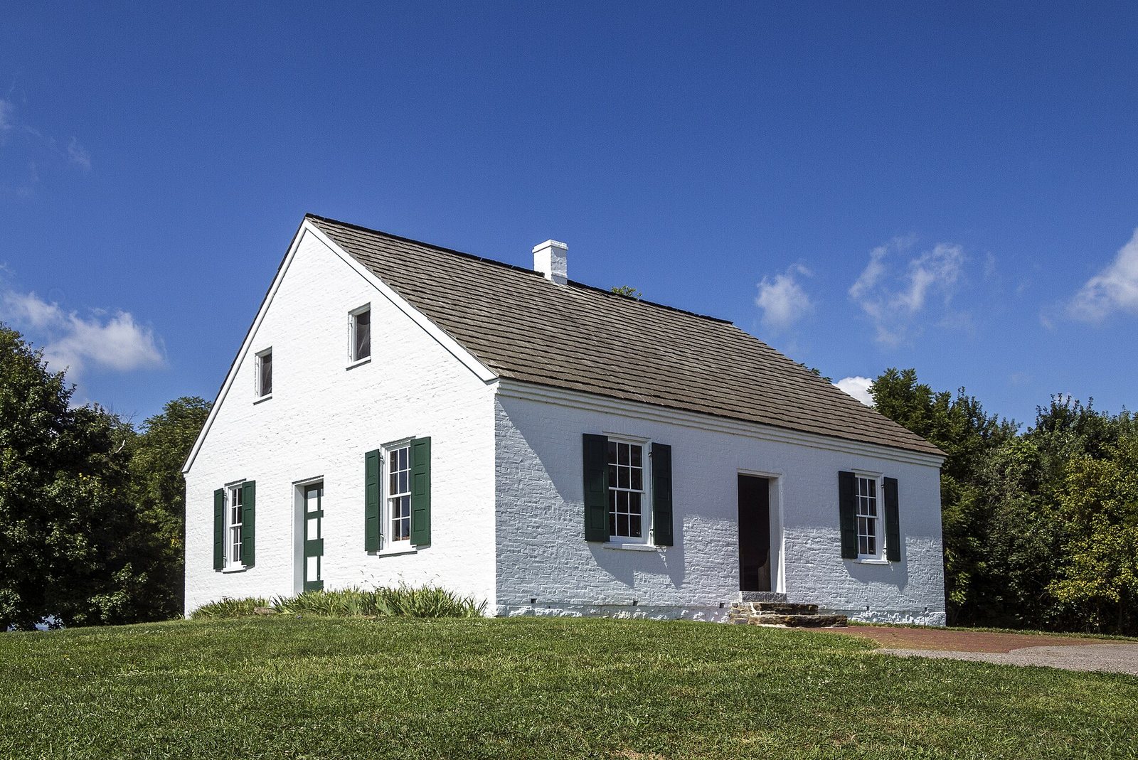
The fighting started at dawn on September 17, 1862, in a farmer’s cornfield north of Sharpsburg, and by nightfall about 23,000 Americans had been killed, wounded, captured or gone missing. No single day in the country’s history has been bloodier. Antietam National Battlefield preserves that ground almost as the soldiers saw it: the same fields, farm lanes, stone bridge and little white church, with far fewer crowds than Gettysburg and a story that changed the course of the Civil War.
Short answer: Give Antietam at least two to three hours: watch the 25-minute film at the visitor center, then drive the 8.5-mile auto tour with stops at the Dunker Church, the Cornfield, Bloody Lane and Burnside Bridge. Entry is $20 per vehicle for three days, paid by card only. It’s about 20 minutes from Hagerstown and 1½ hours from Washington or Baltimore, and it pairs well with South Mountain, Harpers Ferry and Frederick’s Monocacy battlefield.
Fees, hours, programs and event dates on this page were checked September 23, 2026 against the operators’ and agencies’ own websites, mainly the National Park Service.
Fee check for 2026: Antietam charges $20 per vehicle (valid for three days), $15 per motorcycle, $10 per person arriving on foot or by bike, and $35 for an Antietam annual pass. Payment is cashless. If a guide or app still tells you $15 a car, it’s out of date.
On this page: Why Antietam matters · Campaign timeline · Fees, hours and visitor center · Auto tour stop by stop · Hiking trails · 2-3 hours vs a full day · Memorial Illumination · Seasons and crowds · Getting there · Sharpsburg and nearby towns · South Mountain · Monocacy · Harpers Ferry · Gettysburg · Civil War weekend · Maryland’s Civil War sites · Stay and eat · What to skip · FAQ
| At a glance | Details (checked September 2026) |
|---|---|
| Entry fee | $20 per vehicle (3 days), $15 motorcycle, $10 per person on foot or bike, $35 annual; cashless; America the Beautiful passes accepted |
| Visitor center | Daily 9 a.m. to 5 p.m.; closed Thanksgiving, Christmas and New Year’s Day |
| Film | “Remembering Antietam,” 25 minutes, every half hour from 9:30 a.m. |
| Auto tour | 8.5 miles, 11 stops, starting at the Dunker Church |
| Time needed | 2 to 3 hours for the highlights; a full day with trails and a ranger program |
| Where | Sharpsburg, Washington County; about 20 minutes from Hagerstown, 40 from Frederick |
| From DC or Baltimore | About 1½ hours by car; no public transit to the park |
| Visits | 161,006 in 2025 |
| Big dates | Memorial Illumination Saturday, December 5, 2026; 165th anniversary September 17, 2027 |
Why was the Battle of Antietam important?
In early September 1862, fresh from victory at Second Manassas, Robert E. Lee led the Army of Northern Virginia across the Potomac into Maryland, hoping to win over a border state, feed his army from Maryland’s farms and push the Union toward peace. The plan unraveled fast. Union soldiers near Frederick found a copy of Lee’s orders, the famous “Lost Order,” wrapped around cigars, and George McClellan’s Army of the Potomac moved to catch the divided Confederate army. On September 14, the two sides fought for the passes over South Mountain. On September 15, Stonewall Jackson captured the Union garrison at Harpers Ferry, the largest surrender of US troops in the war.
Then, on September 17, the armies met along Antietam Creek. The battle unfolded in three phases, north to south, and the park’s tour follows them:
- Morning: Union attacks through the North Woods, the East Woods and David Miller’s Cornfield toward the Dunker Church, where the fields changed hands again and again.
- Midday: the fight for the Sunken Road, a farm lane that became “Bloody Lane” as Union troops broke the Confederate center at terrible cost.
- Afternoon: Ambrose Burnside’s corps finally forced the stone bridge that now bears his name and pushed toward Sharpsburg, until A.P. Hill’s Confederates arrived from Harpers Ferry and struck their flank.
Lee held his ground on the 18th and retreated across the Potomac that night. Tactically it was a draw; strategically it was the Union victory Abraham Lincoln needed. Five days later, on September 22, 1862, he issued the preliminary Emancipation Proclamation, turning the war into a fight against slavery and making it far harder for Britain or France to recognize the Confederacy. Weeks later, Alexander Gardner’s photographs of Antietam’s dead went on display in New York, the first time most Americans had seen a battlefield’s cost. Clara Barton, later the founder of the American Red Cross, nursed the wounded here under fire, and Lincoln himself came to the battlefield in early October.
The armies and the commanders
The two sides were badly mismatched on paper. McClellan brought roughly 87,000 men to Antietam Creek; Lee had fewer than 40,000 on the field at the start, with A.P. Hill’s division still marching up from Harpers Ferry. McClellan knew Lee’s plans from the Lost Order, yet he attacked in a series of separate blows, north, center and south, instead of all at once, and he kept thousands of men in reserve who never fired a shot. That caution let Lee shift troops from quiet sectors to threatened ones all day, and it’s why walking the field in order, as the tour does, makes the battle click: you can see how close the Confederate line came to breaking in the Cornfield, at Bloody Lane and outside Sharpsburg, and how each crisis passed. Lincoln’s frustration with McClellan’s slow pursuit afterward cost the general his command that November.
The Maryland Campaign, day by day
| Date (1862) | What happened | Where to see it today |
|---|---|---|
| September 4 to 7 | Lee’s army crosses the Potomac into Maryland near Leesburg and marches on Frederick | The C&O Canal towpath at White’s Ford |
| September 10 | Lee divides his army, sending Jackson to capture Harpers Ferry | Frederick, and the National Museum of Civil War Medicine |
| September 13 | Union soldiers find the “Lost Order” near Frederick | Monocacy National Battlefield area |
| September 14 | Battles for Turner’s, Fox’s and Crampton’s gaps on South Mountain | South Mountain State Battlefield and Gathland State Park |
| September 15 | The Union garrison at Harpers Ferry surrenders to Jackson | Harpers Ferry National Historical Park |
| September 17 | The Battle of Antietam | Antietam National Battlefield |
| September 18 to 19 | Lee withdraws across the Potomac at Boteler’s Ford | The river crossing below Shepherdstown |
| September 19 to 20 | The Battle of Shepherdstown, the campaign’s last fight | Shepherdstown, West Virginia |
| September 22 | Lincoln issues the preliminary Emancipation Proclamation | Exhibits at the Antietam visitor center |
| October 1 to 4 | Lincoln visits the army and the battlefield | The Grove Farm near Sharpsburg, where he was photographed with McClellan |
| November 5 | Lincoln removes McClellan from command for failing to pursue Lee | (The end of the campaign) |
Lincoln at Antietam: Abraham Lincoln visited the army from October 1 to 4, 1862, and was photographed with George McClellan and his staff at the Grove Farm on the western edge of Sharpsburg; Alexander Gardner’s pictures of the two men in the general’s tent are among the best-known images of the war. The meeting didn’t go well. Lincoln wanted McClellan to pursue Lee into Virginia, and when the general moved too slowly, Lincoln removed him from command on November 5. The farmhouse is not a stop on the park tour, but the story is told at the visitor center, and driving past it on the way to Shepherdstown puts the photographs in place.
Worth it? Yes. It’s one of the best-preserved Civil War battlefields in the country, the story is clear on the ground, and it’s rarely crowded outside anniversary weekends and the December Illumination.
Best for: history travelers, families with kids old enough for a short trail, and anyone combining Civil War sites with Western Maryland or Frederick.
Not ideal for: a car-free trip; there’s no public transit to the park.
Antietam National Battlefield fees, hours and visitor center
| Pass | Price (2026) | Good for |
|---|---|---|
| Private vehicle | $20 | Everyone in the car, 3 days |
| Motorcycle | $15 | 3 days |
| Per person (walk-in or bike) | $10 | 3 days; ages 15 and under free under NPS rules |
| Antietam annual pass | $35 | 12 months at Antietam |
| America the Beautiful pass | $80 US residents, $250 non-residents | All national parks for a year |
Payment is cashless, so bring a card. The fees are listed on the National Park Service’s Antietam fees page, and the park honors the federal passes, including the senior and military passes.
The visitor center, on a rise off MD 65 north of Sharpsburg, is open daily from 9 a.m. to 5 p.m. except Thanksgiving, Christmas and New Year’s Day. Start here. The 25-minute film, “Remembering Antietam,” runs every half hour from 9:30 a.m. and is the best short introduction to a confusing battle; the museum exhibits cover the armies, the wounded and the aftermath; and an upstairs observation room looks out over much of the northern battlefield, so you can match the map to the land before you drive. The desk hands out free park brochures and trail guides, and rangers lead walking programs daily; check the day’s schedule when you arrive, since program times shift with the season.
Antietam by the numbers
| Fact | Figure |
|---|---|
| Date of the battle | September 17, 1862 |
| Casualties (killed, wounded, captured or missing) | About 23,000, the most of any single day in American history |
| Park established | 1890, as one of the first federally protected battlefields |
| Park size | About 3,200 acres |
| Auto tour | 8.5 miles, 11 stops |
| Visits in 2025 | 161,006 |
| Luminaries at the Memorial Illumination | About 23,000 |
The Antietam auto tour, stop by stop
The self-guided tour runs 8.5 miles through the battlefield in the order the fighting happened, from the Dunker Church north to the Cornfield, south through Bloody Lane and down to Burnside Bridge. Pick up the park map at the visitor center; each stop has markers, and many connect to short trails.
| Stop | What happened | Time needed | Walk or drive |
|---|---|---|---|
| 1. Dunker Church | The white church of a pacifist German Baptist congregation stood at the center of the morning fighting and later served as a field hospital | 15 minutes | Drive; short walk |
| 2. North Woods | Joseph Hooker’s Union corps opened the battle at dawn from these woods | 10 minutes | Drive |
| 3. East Woods | Union reinforcements pushed through toward the Cornfield under heavy fire | 10 minutes | Drive |
| 4. The Cornfield | Miller’s 24-acre cornfield changed hands repeatedly in the morning’s worst fighting | 20 to 45 minutes | Drive, or walk the Cornfield Trail |
| 5. West Woods | A Union division was caught in a crossfire and lost more than 2,000 men in minutes | 15 minutes | Drive; short walk |
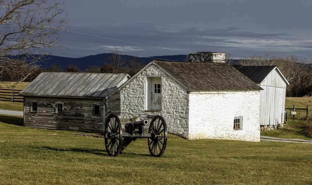
| 6. Mumma Farm | Confederates burned the farmhouse to keep Union sharpshooters out; the family cemetery survives | 10 minutes | Drive |
| 7. Roulette Farm | Union troops crossed the farm lanes toward the Sunken Road | 10 minutes | Drive |
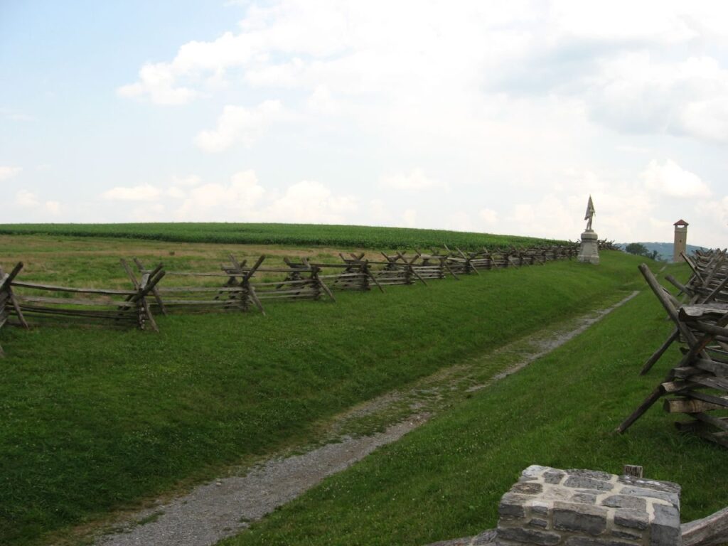
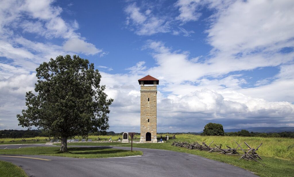
| 8. Sunken Road (Bloody Lane) | About three hours of close fighting at midday; the stone observation tower beside it gives the best view on the field | 30 to 45 minutes | Walk the lane and climb the tower |
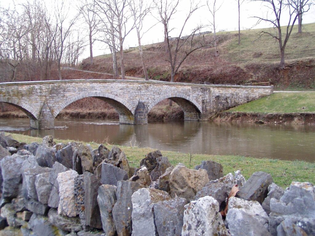
| 9. Burnside Bridge | A few hundred Georgians held the Lower Bridge for hours against Burnside’s corps | 30 minutes | Walk down to the bridge |
| 10. Final Attack | Burnside’s advance toward Sharpsburg, stopped by A.P. Hill’s late arrival | 15 minutes | Drive, or walk the Final Attack Trail |
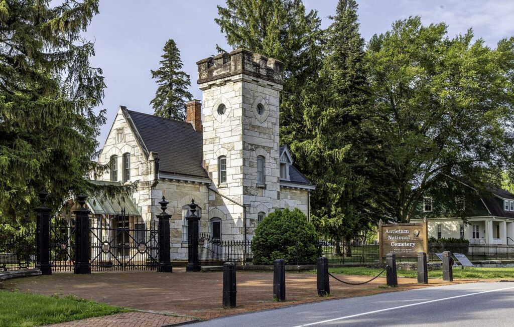
| 11. Antietam National Cemetery | Burial ground for Union soldiers who died at Antietam and other Maryland battles | 15 to 20 minutes | Walk |
Among the monuments worth a stop along the way: the Maryland State Monument near the Dunker Church, which honors Marylanders who fought on both sides, and the tall New York State Monument, visible across the fields. The auto tour is paved and easy, and you can do it in about an hour of driving if you stay in the car, but you’ll understand the battle far better if you get out at the Cornfield, Bloody Lane and Burnside Bridge.
Monuments and markers worth knowing
Antietam has hundreds of monuments, markers and tablets, most placed by veterans and states in the decades after the war, and a few stand out. The Maryland State Monument, dedicated in 1900, is unusual in honoring the state’s soldiers on both sides. The Irish Brigade monument at Bloody Lane marks the charge of the New York and Massachusetts Irish regiments into the Sunken Road. Near the Dunker Church and elsewhere, upside-down cannon barrels set in stone, known as mortuary cannons, mark the spots where six generals, three from each army, were killed or mortally wounded. And a monument to Clara Barton near the Poffenberger farm remembers the nurse who worked in the field hospitals while the battle was still going on.
Antietam National Cemetery
The cemetery on the east edge of Sharpsburg, the last stop on the auto tour, was dedicated on the battle’s fifth anniversary in 1867. It holds Union soldiers who died at Antietam, South Mountain, Monocacy and other Maryland fights, arranged by state around a towering granite statue of a Union private. Confederate dead were not buried here; most were later moved to cemeteries in Hagerstown, Frederick and Shepherdstown. The cemetery is a quiet place to end a visit, and it’s walkable from the center of town.
Hiking trails at Antietam
The best way to understand Antietam is on foot. The park has a network of marked trails, most of them loops of 1 to 2 miles over farm fields and through woods, with a few longer routes for a half-day walk. Pick up the free trail guides at the visitor center. Good choices:
- Cornfield Trail: through the Miller farm fields where the morning fighting raged; the best single walk on the battlefield.
- Bloody Lane Trail: along the Sunken Road and through the Roulette and Mumma farms, with the tower at the end.
- Final Attack Trail: across the rolling ground south of Sharpsburg where Burnside’s attack stalled.
- Snavely Ford Trail: a wooded walk along Antietam Creek downstream from Burnside Bridge, the prettiest trail in the park.
- Union Advance and Three Farms trails: longer routes that link the northern farms and woods.
- Visitor center loops: short walks from the visitor center past the Dunker Church and the Maryland State Monument, and out through the Mumma and Roulette farms.
Trails cross open fields with little shade, so bring water and a hat in summer, stay on mowed paths, and check for ticks afterward. Beyond the park, the Appalachian Trail crosses the South Mountain battlefields a few miles east, and the C&O Canal towpath runs along the Potomac just west of Sharpsburg.
Photography and the best light
The battlefield faces east toward South Mountain, so early morning light comes across the Cornfield and the Dunker Church from behind the ridge, and late afternoon light warms the fields around Bloody Lane and the Final Attack ground, with the Blue Ridge behind you. Fall mornings often bring mist in the creek bottoms near Burnside Bridge. The observation tower is the one place for a wide shot of the whole center of the field, and the fence lines along Bloody Lane make the classic composition. Please stay off the monuments and out of the fields where crops are growing; much of the battlefield is still farmed.
How long does it take to tour Antietam? Two plans
Two to three hours
- Visitor center: the 25-minute film and the observation room (45 minutes).
- Dunker Church and the Cornfield (30 minutes).
- Bloody Lane and the observation tower (30 minutes).
- Burnside Bridge, with the short walk down to the creek (30 minutes).
- Antietam National Cemetery on the way out through Sharpsburg (15 minutes).
A full day
- Morning: the film and museum, then a ranger-led walk if one fits your time.
- Late morning: the Cornfield Trail and the West Woods.
- Lunch in Sharpsburg or Shepherdstown, West Virginia, about 7 minutes away.
- Afternoon: Bloody Lane and the tower, then the Snavely Ford Trail from Burnside Bridge.
- Late afternoon: the Final Attack, the National Cemetery and, in season, the Pry House Field Hospital Museum near Keedysville, where McClellan made his headquarters; it keeps seasonal weekend hours and asks a $5 donation.
What’s the best way to see the battlefield? Drive the auto tour for the big picture, then walk at least one trail. Ranger programs add the human stories, and the tower at Bloody Lane is the one place where the whole middle of the battle makes visual sense.
What to bring
- A card or a federal park pass; the park is cashless.
- Water, a hat and sunscreen for the open fields, even in spring and fall.
- Comfortable shoes for mowed-grass trails and the walk down to Burnside Bridge.
- Binoculars for the view from the observation tower.
- A downloaded map or the park brochure; cell signal is patchy in the creek valley.
- Bug spray and a tick check afterward from late spring to fall.
Antietam with kids
Antietam works for families if you keep it short and physical. Kids can earn a Junior Ranger badge at the visitor center, climb the observation tower at Bloody Lane, walk down to Burnside Bridge and the creek, and count the cannons along the tour road. For children 8 and up, the Cornfield Trail tells the story in a way a museum can’t. Keep younger kids to the tower, the bridge and a picnic, and save the film for older ones, since it doesn’t shy away from the battle’s cost. Children 15 and under enter free.
Accessibility
The auto tour lets visitors with limited mobility see every major site from the car or a short, level walk from parking, and the visitor center has accessible exhibits and the film. The observation tower has stairs only, and the walks down to Burnside Bridge and along the trails cross uneven, sometimes steep ground; ask the desk which stops have the easiest access.
The Memorial Illumination in December
On the first Saturday of December, volunteers set out about 23,000 luminaries across the battlefield, one for each soldier killed, wounded, captured or missing at Antietam. In 2026 it falls on Saturday, December 5. Visitors drive a route of about five miles through the candlelit fields after dark, starting at 6 p.m., and the event is free. It is one of the most moving sights in Maryland, and one of the busiest: cars line up for hours on the roads toward Sharpsburg, so bring patience, a full tank and snacks, and consider arriving later in the evening when the first wave has cleared. Check the park’s website the week before, since weather can change the plan.
Seasons and crowds
Antietam recorded 161,006 visits in 2025, a fraction of what Gettysburg sees, so it rarely feels crowded. A few patterns help:
- Spring (March to May) is peak season for school groups; weekday mornings can be busy at the visitor center, and afternoons are quieter.
- Summer is hot on the open fields; walk early and keep the afternoon for the museum and the drive.
- September brings anniversary programs around the 17th; 2027 marks the 165th anniversary.
- October is the prettiest month, with fall color on South Mountain and the Blue Ridge behind the fields.
- December means the Memorial Illumination, then the quietest weeks of the year.
Getting there: where is the Antietam visitor center?
The visitor center is on MD 65 (Sharpsburg Pike), about a mile north of Sharpsburg in Washington County. You need a car: there’s no public transit to the park, and MARC’s Brunswick Line toward Harpers Ferry runs only on weekdays. Free-flow driving times:
| From | Driving time | Route |
|---|---|---|
| Hagerstown | About 20 minutes | MD 65 south |
| Frederick | About 40 minutes | US 40 Alternate or I-70 and MD 34 |
| Washington, DC | About 1½ to 1¾ hours | I-270, I-70 and MD 34 or MD 65 |
| Baltimore | About 1½ hours | I-70 west |
| Philadelphia | About 3 to 3¾ hours | I-76 or I-83 and I-81 |
| Pittsburgh | About 3¼ to 3¾ hours | I-76, I-70 and I-81 |
| Richmond | About 3 to 3½ hours | I-95 and I-270, or US 340 through Harpers Ferry |
Parking is at the visitor center and at the tour stops. Hagerstown, 20 minutes north, and Frederick, 40 minutes east, are the nearest cities with plenty of hotels.
Sharpsburg, Boonsboro and Shepherdstown
Sharpsburg, laid out in 1763, is the small brick town the battle swirled around; houses on Main Street still show where shells struck, and its few B&Bs and cafes are the closest lodging to the park. Boonsboro, about 10 minutes northeast on MD 34, sits at the foot of South Mountain with a short main street and easy access to Washington Monument State Park and Greenbrier State Park. Keedysville, between the two, is home to the Pry House Field Hospital Museum. And Shepherdstown, West Virginia, just across the Potomac and about 7 minutes from Sharpsburg, is one of the state’s oldest towns, with a college, inns and the area’s best choice of restaurants along German Street.
In summer, outfitters run tubing and kayak trips on Antietam Creek and the nearby Potomac, a cool way to see the creek the armies fought over; check with the outfitter about water levels, which drop in dry spells.
The Battle of Shepherdstown
The campaign’s last fight happened across the river on September 19 and 20, 1862, when Union troops pushed across the Potomac at Boteler’s Ford below Shepherdstown and were thrown back by A.P. Hill’s division. The ford and the bluffs above it are a short drive from Sharpsburg, and the site gets a fraction of Antietam’s visitors, which suits the history buff who has already seen the main field.
For a bigger base, Hagerstown and the rest of Western Maryland are just north, with the C&O Canal, Fort Frederick and the mountain towns along I-70 and I-68.
South Mountain State Battlefield
Three days before Antietam, on September 14, 1862, the armies fought for the three gaps over South Mountain: Turner’s Gap on the National Road, Fox’s Gap just south, and Crampton’s Gap near Burkittsville. The Union won the passes but lost a day, which gave Lee time to gather at Sharpsburg. Today the ground is South Mountain State Battlefield, run by Maryland’s Department of Natural Resources, and it’s the best place to combine a hike with the Maryland Campaign.
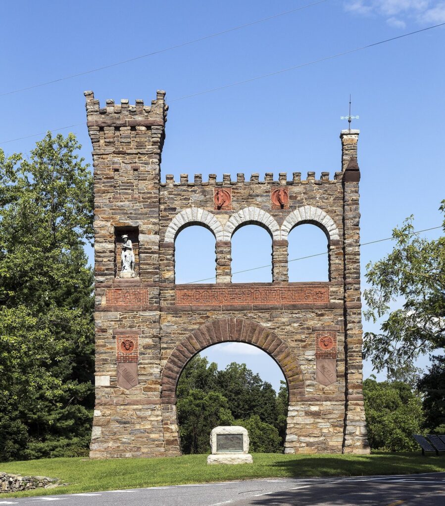
- Gathland State Park at Crampton’s Gap: the War Correspondents Memorial Arch, built by the Civil War correspondent George Alfred Townsend, known as “Gath,” and dedicated on October 16, 1896, lists more than 150 correspondents and artists who covered the war. A 0.6-mile interpretive trail below it explains the late-afternoon fighting at the gap.
- Fox’s Gap: the Reno Monument marks where Union Gen. Jesse Reno was killed. The Appalachian Trail between Turner’s and Fox’s gaps follows a road the soldiers used in 1862.
- Turner’s Gap and Washington Monument State Park: the northern end of the fight, with the 1827 Washington Monument on the ridge just north.
Plan it: the South Mountain gaps are about half an hour from Hagerstown or Frederick, and Burkittsville is about 20 minutes from Sharpsburg. An easy loop is Antietam in the morning and Gathland and Fox’s Gap in the afternoon.
Monocacy National Battlefield
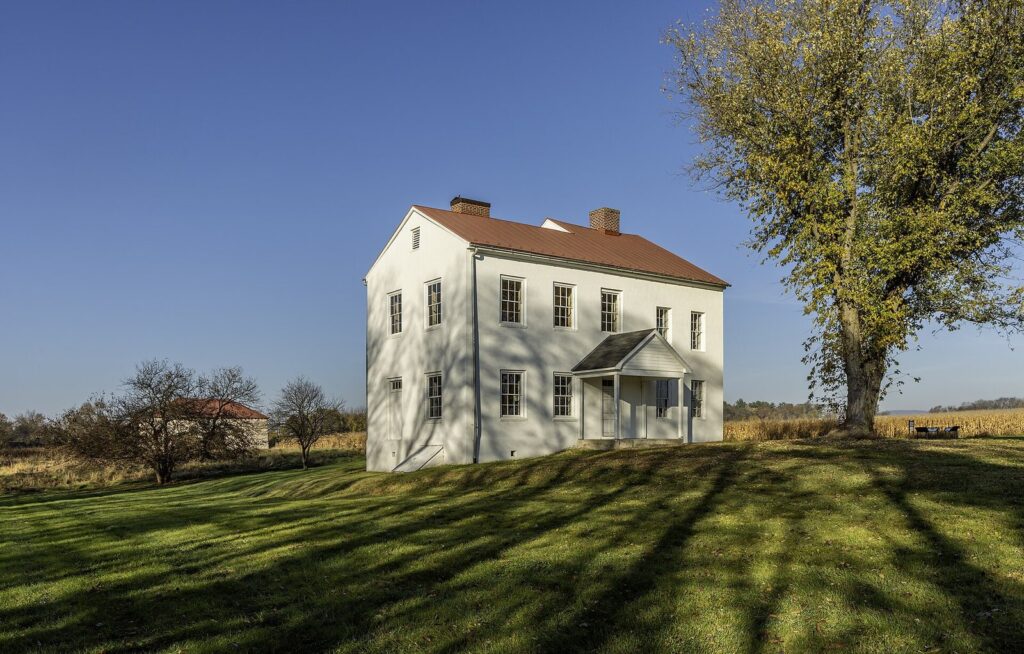
On July 9, 1864, Union Gen. Lew Wallace, later the author of “Ben-Hur,” threw a small force across Jubal Early’s path at the Monocacy River just south of Frederick. Wallace lost the battle but cost Early a full day, and by the time the Confederates reached Washington’s outskirts, reinforcements had arrived. That’s why Monocacy is called “the battle that saved Washington.” The park is free, its visitor center opens Thursday through Monday from 9 a.m. to 5 p.m., and a short driving tour links the Best, Thomas and Worthington farms, with trails along the river. See the National Park Service’s Monocacy page for current programs.
Monocacy is 12 to 13 minutes from downtown Frederick, Maryland, which also has the National Museum of Civil War Medicine on East Patrick Street ($9.50 admission; Monday to Saturday 10 a.m. to 5 p.m., Sunday 11 a.m. to 5 p.m.). The museum runs the Pry House at Antietam and makes an excellent rainy-day complement to the battlefields.
Harpers Ferry: the West Virginia day trip
Harpers Ferry National Historical Park, at the meeting of the Potomac and Shenandoah rivers about 25 minutes from Sharpsburg, is part of the same story: John Brown’s 1859 raid on the federal armory, and Jackson’s capture of the Union garrison two days before Antietam. The lower town’s restored streets, museums and river views make a half-day. The park charges $20 per vehicle for three days, or $10 per person, cashless.
One important 2026 change: the Byron footbridge over the Potomac between Maryland and Harpers Ferry has been closed since July 27, 2026. That cuts the easy walk from the C&O Canal towpath and makes the Maryland Heights trail harder to reach; the Park Service has run a shuttle from the C&O’s Lock 34 area during the closure. Check the Harpers Ferry park site before you plan a walk-in visit.
Gettysburg: pairing the two battlefields
Gettysburg, Pennsylvania, is a little over an hour north of Sharpsburg, and many visitors do both on one trip. They’re different experiences. Gettysburg, fought July 1 to 3, 1863, is bigger, busier and surrounded by a tourist town; Antietam is quieter, more rural and easier to take in in half a day. A two-day plan works well: Antietam and South Mountain on day one with a night in Hagerstown or Frederick, and Gettysburg on day two. If you only have time for one, choose Antietam for the landscape and a single day’s story, and Gettysburg for the scale.
A Civil War weekend in Maryland
With two days, you can follow the whole Maryland Campaign of 1862 and add the 1864 battle that saved Washington:
- Day 1 morning, Monocacy and Frederick: the free Monocacy battlefield (Thursday to Monday for the visitor center), where the Lost Order was found near the Best Farm, then the National Museum of Civil War Medicine downtown and lunch in Frederick.
- Day 1 afternoon, South Mountain: about half an hour west, the War Correspondents Arch at Gathland and a short walk at Crampton’s Gap or Fox’s Gap. Sleep in Frederick, Boonsboro, Sharpsburg or Shepherdstown.
- Day 2 morning, Antietam: the film, the tower at Bloody Lane and the Cornfield Trail.
- Day 2 afternoon, Harpers Ferry or Gettysburg: Harpers Ferry is about 25 minutes south (check the footbridge status if you plan to walk from Maryland); Gettysburg is a little over an hour north if you want to see where the war turned the next summer.
From Washington or Baltimore, reverse the order if you’d rather start with Antietam while you’re fresh: it’s the site that rewards the most time on foot.
Maryland’s Civil War sites: the short list
Maryland was a slave-holding border state that stayed in the Union, and the war crossed it again and again. Beyond Antietam, these are the sites worth your time:
| Site | Where | Why go | Cost (2026) |
|---|---|---|---|
| Antietam National Battlefield | Sharpsburg | The bloodiest day in American history, September 17, 1862 | $20 per vehicle |
| South Mountain State Battlefield | Boonsboro to Burkittsville | The September 14, 1862 fight for the mountain gaps; the War Correspondents Arch | Free |
| Monocacy National Battlefield | Frederick | “The battle that saved Washington,” July 9, 1864 | Free |
| National Museum of Civil War Medicine | Frederick | Surgery, nursing and field hospitals | $9.50 |
| Pry House Field Hospital Museum | Keedysville | McClellan’s headquarters and a field hospital | $5 suggested donation; seasonal |
| Harpers Ferry National Historical Park | Harpers Ferry, WV | John Brown’s raid and the 1862 surrender | $20 per vehicle |
| Point Lookout State Park | Southern tip of St. Mary’s County | The Union’s largest prison camp for Confederate soldiers | $5 per person ($7 out of state) on summer weekends |
| Fort Washington Park | Prince George’s County | The fort that guarded the Potomac approach to Washington | No entrance pass required |
| Booth’s Escape Scenic Byway | Prince George’s and Charles counties | John Wilkes Booth’s flight after Lincoln’s assassination in 1865 | Free to drive |
Smaller stories are scattered through Western Maryland too: Lee’s army retreated from Gettysburg through Hagerstown and crossed the Potomac at Williamsport in July 1863; Confederate cavalry ransomed Hagerstown in 1864 and Frederick paid a ransom to Jubal Early the same summer; and in February 1865 Confederate raiders captured two Union generals in their Cumberland hotels.
Where to stay and eat near Antietam
- Sharpsburg and Keedysville: B&Bs and inns within minutes of the park; book ahead for September anniversary weekends and the Illumination.
- Shepherdstown, West Virginia: inns and the best cluster of restaurants near the battlefield, about 7 minutes from Sharpsburg.
- Boonsboro: a small-town base for South Mountain and Greenbrier State Park.
- Hagerstown: the most chain hotels, 20 minutes north, handy for I-70 and I-81.
- Frederick: historic inns, hotels and the best dining in the area, 40 minutes east, with Monocacy and the Civil War medicine museum on the doorstep; Frederick County’s hotel tax is 5%.
There’s no restaurant inside the park, so plan lunch in Sharpsburg, Shepherdstown or Boonsboro, or pack a picnic; the grounds have a few picnic spots, but the fields themselves are memorial ground.
If it rains
Antietam’s fields are miserable in a downpour, but the visitor center’s film, museum and observation room still work, and the auto tour can be driven with the windows fogged and the brochure in hand. For the rest of the day, the National Museum of Civil War Medicine in Frederick is indoors and absorbing, the Pry House opens on its seasonal weekends, and Hagerstown’s free Washington County Museum of Fine Arts is 20 minutes north.
What to skip
Skip the drive-by. Staying in the car the whole way sees the monuments but misses the battle. Walk at least the Cornfield or Bloody Lane.
Skip bringing cash. The park is cashless; a card or a federal pass is all you need.
Skip a noon arrival in July. The fields are open and hot; come early and save the afternoon for the museum.
Don’t plan a walk-in from the towpath to Harpers Ferry. The Byron footbridge has been closed since July 27, 2026.
Don’t arrive at 6 p.m. sharp for the Illumination unless you like long lines; later in the evening moves faster.
Frequently asked questions
How much does it cost to visit Antietam National Battlefield?
In 2026 the entrance fee was $20 per private vehicle, good for three days, $15 per motorcycle, and $10 per person for walkers and cyclists, with a $35 Antietam annual pass. Payment is cashless. America the Beautiful passes are accepted ($80 a year for US residents, $250 for non-residents). The visitor center film and ranger programs are included.
How long does it take to tour Antietam?
Plan two to three hours for the highlights: the 25-minute film, the observation room and the 8.5-mile auto tour with stops at the Dunker Church, the Cornfield, Bloody Lane and Burnside Bridge. A full day lets you add a ranger program, one or two trails and the National Cemetery. The drive alone takes about an hour.
What is the best way to see the Antietam battlefield?
Start at the visitor center with the film and the observation room, then drive the 11-stop auto tour in order, getting out at the Cornfield, Bloody Lane (climb the observation tower) and Burnside Bridge. Walk at least one trail, such as the Cornfield Trail or the Snavely Ford Trail, and join a ranger program if the timing works.
Where is the Antietam visitor center?
On Sharpsburg Pike (MD 65), about a mile north of the town of Sharpsburg in Washington County, Maryland. It’s about 20 minutes south of Hagerstown, 40 minutes west of Frederick, and about 1½ hours from Washington, DC, or Baltimore. It opens daily from 9 a.m. to 5 p.m., except Thanksgiving, Christmas and New Year’s Day.
Is Antietam worth visiting?
Yes. It’s one of the best-preserved Civil War battlefields in the country, far less crowded than Gettysburg, and the story of September 17, 1862, is easy to follow on the ground. Two or three hours covers the essentials, and nearby South Mountain, Harpers Ferry and Monocacy make it a full Civil War weekend.
Why was the Battle of Antietam important?
It ended Robert E. Lee’s first invasion of the North and gave Abraham Lincoln the victory he needed to issue the preliminary Emancipation Proclamation on September 22, 1862. That made ending slavery a Union war aim and discouraged Britain and France from recognizing the Confederacy. With about 23,000 casualties, it remains the bloodiest single day in American history.
When is the Antietam Memorial Illumination?
It’s held on the first Saturday of December; in 2026 that’s Saturday, December 5. About 23,000 luminaries, one for each casualty of the battle, line a drive of about five miles through the battlefield after dark, starting at 6 p.m. The event is free, but traffic lines are long, so arrive later in the evening and check the park’s website for weather changes.
Can you walk the Antietam battlefield?
Yes. The park has marked trails, most of them 1- to 2-mile loops across the fields where the fighting happened, including the Cornfield, Bloody Lane, Final Attack and Snavely Ford trails. You can also walk from the visitor center to the Dunker Church and the Maryland State Monument. Walkers and cyclists pay $10 per person instead of the $20 vehicle fee.
Related Maryland guides
- Frederick, MD: downtown, Monocacy and Catoctin
- Western Maryland attractions: Hagerstown, Cumberland and the mountains
Sources and verification
Everything on this page was checked on September 23, 2026 against the organizations listed below, and the guide is compiled from their published information rather than from first-hand visits.
- National Park Service: Antietam National Battlefield
- NPS: Antietam fees and passes
- NPS: The Memorial Illumination
- NPS: Monocacy National Battlefield
- NPS: Harpers Ferry National Historical Park
- Maryland DNR: South Mountain State Battlefield
- National Museum of Civil War Medicine and the Pry House
Also consulted: the NPS visitation statistics office for 2025 visit counts, Visit Hagerstown and Washington County, the Maryland Transit Administration (MARC schedules) and the NPS pages for Fort Washington Park and the national passes. Drive times are free-flow estimates from OSRM and Valhalla routing.
Maryland Tourism Guide is an independent publication. It is not affiliated with Visit Maryland or any agency or business named here, and no one paid to be included.
Photo credits
- Dunker Church, Antietam (featured image): photo by Acroterion, Wikimedia Commons (CC BY-SA 4.0)
- Bloody Lane (Sunken Road), Antietam: photo by Ken Lund from Las Vegas, Nevada, USA, Wikimedia Commons (CC BY-SA 2.0)
- Observation tower, Antietam: photo by Acroterion, Wikimedia Commons (CC BY-SA 4.0)
- Burnside Bridge, Antietam: photo by Chris Light, Wikimedia Commons (CC BY-SA 4.0)
- Mumma Farm, Antietam: photo by Acroterion, Wikimedia Commons (CC BY-SA 4.0)
- Antietam National Cemetery entrance: photo by Acroterion, Wikimedia Commons (CC BY-SA 4.0)
- War Correspondents Memorial Arch, Gathland State Park: photo by Acroterion, Wikimedia Commons (CC BY-SA 4.0)
- Best Farm, Monocacy National Battlefield: photo by Acroterion, Wikimedia Commons (CC BY-SA 4.0)